Venturing into the great outdoors promises adventure, peace, and the wonders of nature. However, it’s not all smooth sailing. Navigating remote wilderness areas poses challenges, ensuring you stay aware of unexpected hurdles like navigating rugged terrain or dealing with sudden weather changes while searching for the perfect campsite. As we navigate these challenges, it’s important to remember that practicality is crucial, even amidst the dreamy allure of exploration.
In today’s world, technology and careful planning provide tools that enhance outdoor adventures, making them safer and more connected. Exploring remote and rugged terrains requires precise navigation for a safe journey.
Whether you’re a seasoned overlander or new to off-road adventures, having the right navigation tools is essential. These tools let us stay connected while taking a break from our daily grind.
How does GPS navigation work?
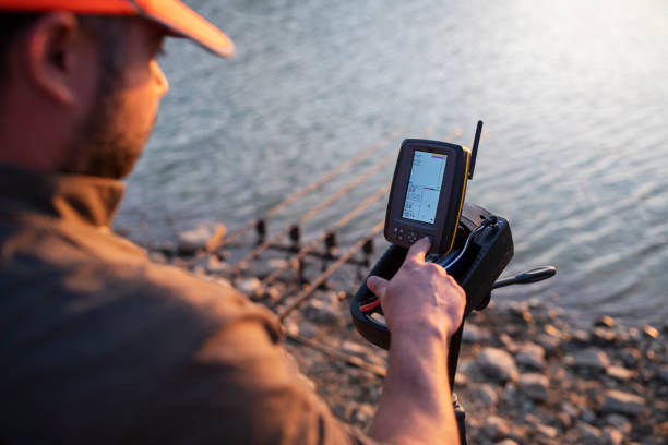
Your GPS navigation operates through a network of orbiting satellites, delivering signals that carry crucial location details and precise time data. When you’re out in the wilderness, your camping GPS receiver intercepts these signals and calculates the distances between itself and the satellites.
The GPS receiver determines your specific camping location, including latitude, longitude, and altitude, by triangulating signals from at least three satellites.
The accuracy of your camping GPS depends on receiving signals from multiple satellites simultaneously.
This precise positioning technology enhances camping navigation and contributes to activities like mapping, geocaching, and accessing location-based services, making it an indispensable tool for modern outdoor enthusiasts.
Do I Need GPS Navigation for the Wild?
When camping in unfamiliar terrain, a GPS navigation device becomes an essential companion. If you frequently explore new camping spots beyond your comfort zone, the answer is clear—yes, you should be equipped with a GPS.
Navigating the wild is an exhilarating adventure, but it presents challenges. A GPS enhances your camping experience by providing detailed maps, waypoints, and real-time tracking, ensuring you can navigate trails, locate campsites, and find your way back if you deviate from the course.
A GPS offers peace of mind and confidence in your outdoor adventures, whether exploring remote wilderness areas or embarking on multi-day hikes. Make the most of your camping trips by embracing the valuable assistance of a GPS navigation device.
Essential Apps for Off-Grid Navigation
Accurate navigation goes beyond knowing your location; it involves understanding the surrounding terrain, identifying landmarks, and planning routes. Modern navigation tools cater to these needs, offering information in easily accessible digital formats.
- Maps.me
Maps. Me is an essential free app for off-the-grid explorers. It enables you to download detailed topographical maps globally for offline use. These maps present elevation data, terrain features, and points of interest such as campsites and water sources—vital for route planning and situational awareness.
Even without a cellular signal, Maps.me offers turn-by-turn navigation on downloaded maps. Trusted by over 140 million travellers worldwide, the offline maps are packed with valuable information, including roads, hiking trails, and bike paths, making them indispensable tools for any adventurer.
- Gaia GPS
For adventurers seeking advanced functionality, Gaia GPS offers a subscription-based option. This goes beyond basic navigation and unlocks powerful tools like downloadable topographical maps, track recording, waypoint marking, and route planning. You can customize map layers with weather overlays and public land boundaries, which is perfect for in-depth planning and route analysis.
Whether you’re conquering snowy peaks, exploring intricate hiking trails, or navigating off-road routes, Gaia GPS equips you with the necessary information.
Gaia GPS app prioritizes user experience. Spend less time fiddling with your phone and more time immersed in the beauty of nature. Whether you’re backpacking, overlanding, searching for campgrounds, planning ski routes, or hiking trails, Gaia GPS streamlines the process, allowing you to seamlessly navigate your wilderness adventure.
- OsmAnd
OsmAnd is a free, offline mapping app perfect for budget-conscious adventurers. Unlike some other apps, It offers all the essentials for free, including downloadable topographical maps for offline use. This ensures you can navigate with confidence even in areas without cell service. The app boasts an active community that contributes to keeping maps updated.
Plus, it provides valuable features like turn-by-turn navigation and route planning, helping you stay on track and reach your camping destination with ease. While donations are encouraged to support the project’s development, you can enjoy the core functionalities without spending a dime.
- Locus Map Pro
Locus Map Pro emerges as a powerhouse for experienced adventurers searching for a comprehensive toolkit. This premium app offers advanced features such as downloadable topographic maps, versatile route planning tools (including elevation profiles, track recording, and GPX import/export), and seamless integration with external sensors like barometers for altitude data.
Tailored for seasoned explorers requiring a robust set of navigation tools, Locus Map Pro proves to be a worthwhile investment for those seeking enhanced capabilities and precision in their outdoor pursuits.
- Google Earth
While not your usual phone app, Google Earth proves invaluable for planning outdoor adventures. It aids in mapping out hikes by importing KML files (think of them as Google’s version of GPX).
The 3D view is fantastic for assessing elevation changes, surveying the terrain, and identifying features like water sources. It provides a straightforward method to visualize topographic maps.
Additionally, Google Earth offers details about landmarks such as mountains and rivers, making it an all-in-one tool for planning a camping trip. Despite not being a conventional app, it certainly gets the job done easily.
Planning for Success: Navigate Wisely and Safely
While technology is a powerful asset, remember these essential tips for a safe and successful off-the-grid adventure:
- Master the Basics: Before venturing out, learn how to use your GPS unit’s functionalities, such as waypoint marking, navigation features, and map interpretation.
- Always Carry a Backup: A physical topographical map is a crucial backup in case of electronic device failure or limited battery life.
- Download Strategically: Downloading detailed maps can eat up storage space. Focus on downloading maps for your specific camping area.
- Inform Someone: In remote regions with limited cell service, always inform someone of your planned route and estimated return time.
Conclusion
Planning to go off the grid? Well, your golden ticket to navigating the wilderness confidently is having the right tools. It doesn’t matter if you’re a seasoned adventurer or just starting – getting the hang of off-grid navigation is a game-changer for all your outdoor exploits. In the vast world of off-grid navigation, staying informed and prepared is the game’s name.
Get your hands on the latest tools, polish those navigation skills, and brace yourself for the excitement of exploring uncharted territories. So, as you gear up for your next outdoor escapade, trust your compass to keep you on track, and let your GPS tools be your trusty sidekicks in the great outdoors.
Gear up for the ultimate off-road experience with Kermode Overlanding. Explore our top-notch selection of outdoor gear designed to elevate your navigation game. From GPS devices to essential camping tools, we’ve got you covered. Your journey begins here—trust Kermode Overlanding for quality gear that redefines outdoor exploration. Ready to gear up and go? Start your adventure with us!


